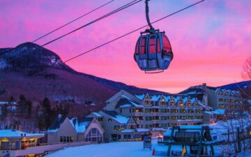
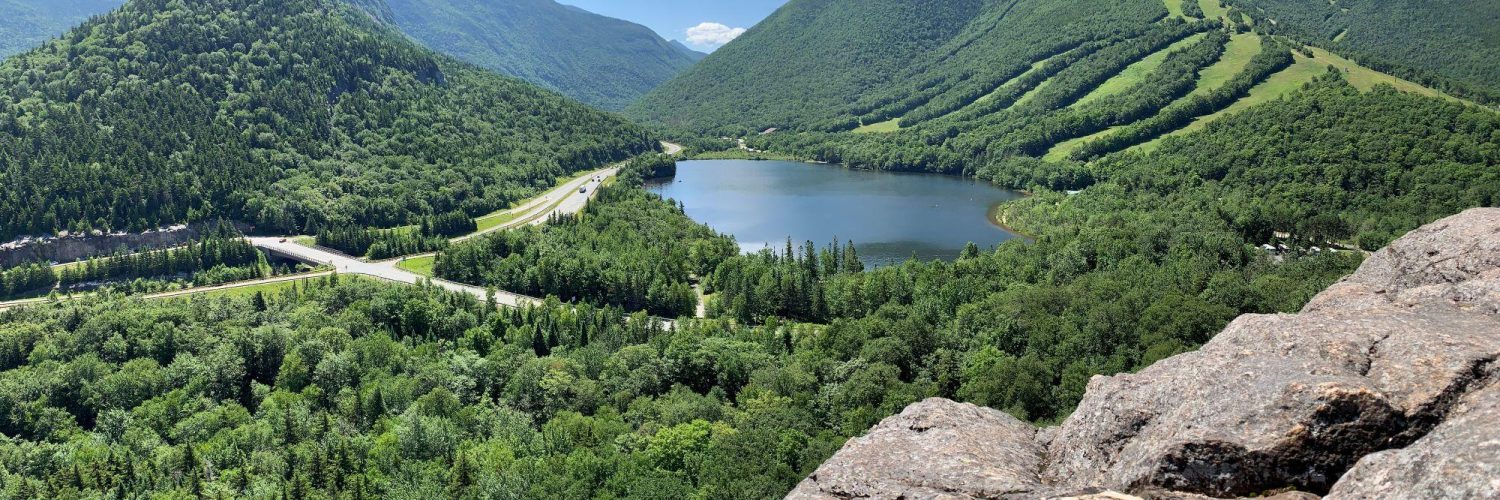
CANNON MOUNTAIN

LIFTS & TRAILS
VERTICAL DROP
2180
TOTAL ACREAGE
285
NUMBER OF TRAILS
97
NUMBER OF LIFTS
11
SNOWMAKING
Cannon 92%
Mittersill 63%
CONDITIONS
NEW SNOW
0"
BASE DEPTH
10-20"
SURFACE CONDITIONS
Machine Groomed
LAST UPDATED
12.15.2019
PROXIMITY
Loon Mountain Resort
16.6 mi (34 mins)
Bretton Woods
17.3 mi (24 mins)
Waterville Valley Resort
37.9 mi (44 mins)
Black Mountain
46.1 mi (1 hour 2 mins)
Cranmore Mountain Resort
48.0 mi (1 hour 4 mins)
Dartmouth Skiway
49.1 mi (1 hour 18 mins)
King Pine
57.6 mi (1 hour 20 mins)
Ragged Mountain Resort
59.3 mi (1 hour 5 mins)
Gunstock Mountain Resort
63.3 mi (1 hour 13 mins)
Abenaki Ski Area
66.2 mi (1 hour 25 mins)
Whaleback Mountain
72.1 mi (1 hour 29 mins)
Mount Sunapee Resort
83.4 mi (1 hour 38 mins)
McIntyre Ski Area
90.0 mi (1 hour 27 mins)
Pats Peak
94.2 mi (1 hour 31 mins)
KIDS PROGRAMS
The Cannon Mountain Snowsports School has excellent programs for kids that will keep kids engaged and excited about skiing and riding! Cannon Kids: Ages 4-7; Mountain Explorers: Ages 8-12; and Tykes: 3 years old only.
MORE >
CANNON MOUNTAIN
Franconia Notch Parkway
Franconia, NH, 03580
Phone:
603-823-8800
Snowphone:
603-823-7771
Email:
Website:
Big-mountain skiing at a small-mountain price. Features diverse terrain across two mountains and the highest ski area summit in NH at 4080', including the popular Tuckerbrook Family Area for beginners and families.
WHAT'S NEW:
Last winter Cannon churned out the most snow in its history, burying trails and opening new terrain faster than ever before possible. Our $5.1 million energy-efficiency initiative with over 400 state-of-the-art tower guns kicked our system into overdrive and we’ll be back at it again for ‘17–18. PLUS:
$250K upgrades to snowmaking
$135K Mittersill warming hut for public
$200K in lift upgrades
$150K state of the art tuning machine
DON'T MISS: New Hampshire’s highest beer tap at the 4080' Cafe on the summit; Saturday Family Fun Nights; Freeride Series in the Tossup Terrain Park, 80’s Day & the Old School Duel.
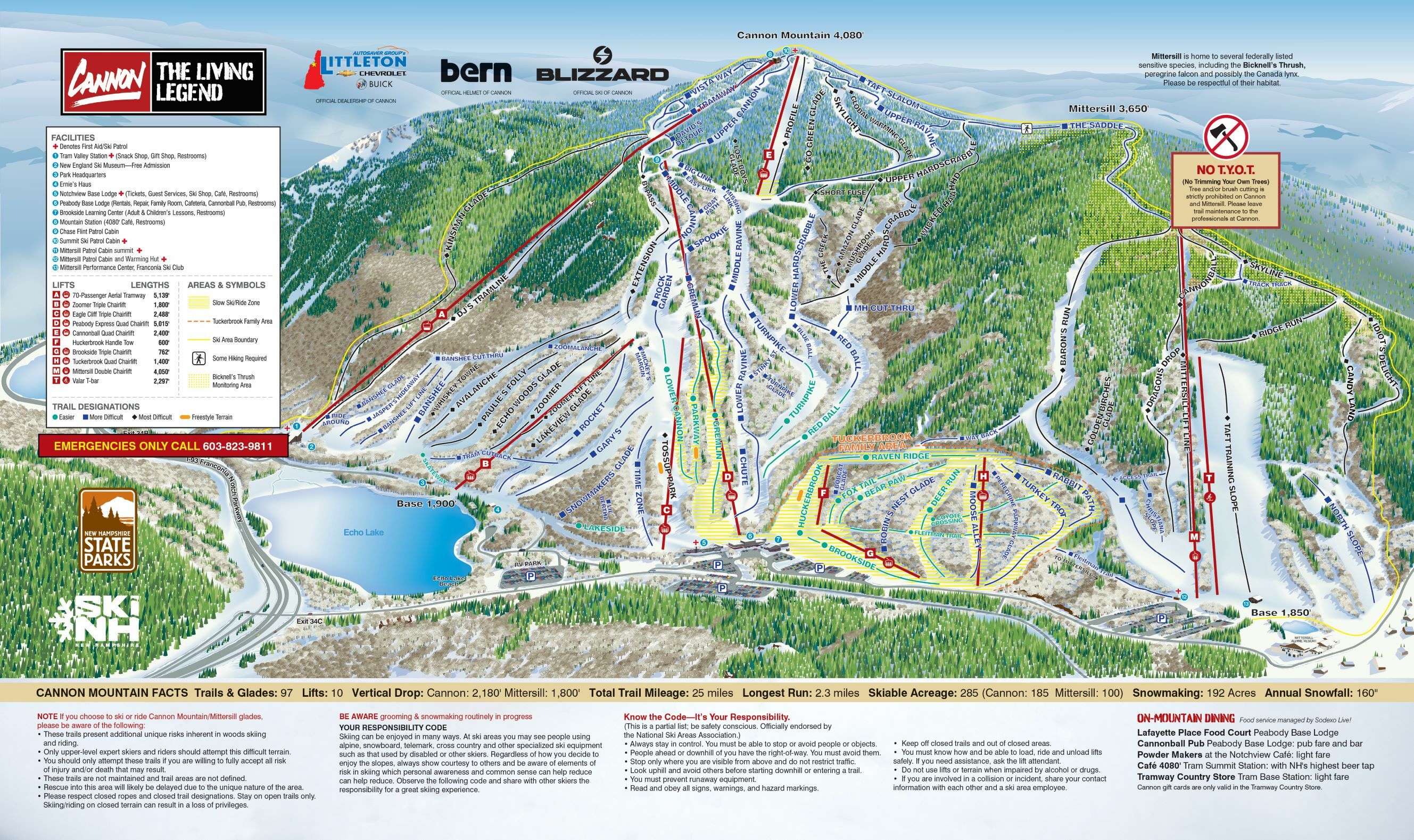
Click map for a larger version